ocean plastic detection
In order to remove plastic from the ocean we need to know both where it accumulates and what form it takes. By establishing its location and assessing the waste in advance, ocean plastic can be targeted with the right equipment to combat it. Three main techniques are used to do so: numerical modelling, in situ monitoring and satellite monitoring. In terms of location, we are looking at where the waste is found in relation to distance from the shore - from inland waterways via beaches out to the open ocean - and in relation to depth - accumulations of plastics are found at the surface, down through the water column, on the ocean floor and embedded in the sediment there. It is also important to differentiate between macroplastic and microplastic waste as both the detection methods and the cleanup strategies differ accordingly.

The Ocean Cleanup

The Ocean Cleanup

Karl Greif/Unsplash

Andrew Wulf
Numerical modelling uses our knowledge of how currents, tides, upwellings and downwellings, thermohaline circulation and the gyres keep the ocean in constant motion. It is not only the water which is moved around the planet but everything it carries flows with it - from nutrients to pollution. Using modelling which takes into account how currents work and how ocean water layers mix (depending on their temperature, salinity and chemical composition), predictions can be made as to how long a piece of plastic takes to move and which direction it follows.
Back in 1992, a storm in the Pacific triggered one of the largest and most unusual studies into global ocean currents when a container ship travelling from Hong Kong to the United States lost a container carrying nearly 30,000 plastic bath toys. These yellow ducks began a journey around the world, carried by the currents and winds, with the first group found nearly a year later on the shores of Alaska, about 3,200 kilometres from their point of departure. Others were discovered in Japan and Australia and one even made it to Scotland. Each sighting of a duck was recorded into a computer model, the Ocean Surface Currents Simulation (OSCAR). The durability of plastic has meant that the ducks were still being found in good condition twenty years later and it is thought that about 2,000 are still floating around today, probably caught in one of the five gyres. Since then a number of projects have been following this line, such as Plastic Adrift, the Tracking of Plastic in Our Seas (TOPIOS) project and the Ocean Cleanup Plastic Tracker. The Tracker predicts the forward path of pollution, showing where a bottle dropped anywhere in the world is likely to end up. Working backwards, models can also evaluate the reverse path and predict with relative accuracy the source of the pollution.
In situ monitoring of ocean plastic involves conducting surveys of the amount and size of plastic seen in a specific place over a given time. The methods used vary from the assessment of plastic collected at a beach cleanup, via vessel observation projects counting items seen on the ocean surface over a given period of time or collected in special nets from onboard a research vessel, to investigations of the digestive tracts of marine life to see if any plastic has been ingested.
Macroplastic on the ocean surface has been observed and documented from on board vessels for decades but again without a globally-accepted method. With the development of a number of mobile phone apps, new possibilities for ocean-related citizen science will help establish a wider database of information based on the same methodology. The Ocean Cleanup apps for both rivers and oceans have been designed for use by anyone, whether on board a merchant, fishing or private vessel, or located near a river. They invite users to conduct a 30-minute survey and register the results, and will use the data to both understand how and where floating plastic accumulates, all of which will help shape their cleanup strategy.
Research is also ongoing into how the global merchant fleet could be used to collect data on ocean plastic accumulation while going about its normal business with the simple installation of GPS-enabled cameras on their decks, feeding footage into an algorithm capable of identifying objects and helping decide where the next ocean cleanups need to be held. Land-based cameras are also being employed to monitor the amount of debris flowing from rivers into the sea. A research project run by the Commonwealth Scientific and Industrial Research Organisation (CSIRO) uses surveillance cameras on the River Thames in London, the river Derwent in Hobart and the Buriganga river in Dhaka to take regular photos of river waste while The World Bank is running similar projects to identify plastic and collect data on rivers in Cambodia, Myanmar and the Philippines.
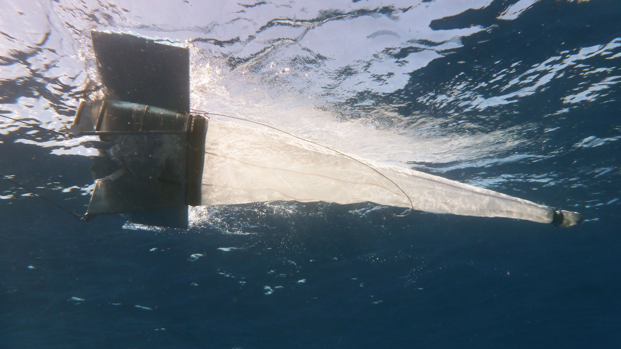
As far as floating plastic goes, surveys have evolved using the same nets marine scientists use to measure levels of plankton in the water. Manta trawls and neuston nets, great sieve-like nets with a mesh size of about 0.125 mm, pick up floating plastic which is then counted and weighed, allowing for an approximate figure for a given area. These have however proved insufficient at collecting either microplastic fibres or beads for research purposes.
Microplastic detection remains tricky and no simple system yet exists, meaning that they are being measured differently by researchers all over the world, making it difficult to put together reliable and comparable data. Work is underway to rectify this: the Government of Japan's Ministry of the Environment has issued Guidelines for Harmonizing Ocean Surface Microplastic Monitoring Methods.
Monitoring the vertical distribution of plastic is more challenging. Most ocean plastic is buoyant unless pushed below the surface (usually by strong winds) or made heavier through bio-fouling. The Multi-Level Trawl, a new way to monitor microplastic concentrations at various different depths in the water column, is being tested by The Ocean Cleanup. According to their studies so far, about 90% of the plastic in the GPGP is located in the top 5 metres of the upper 2,000 metres of the water column, with just 10% found in the depths below.
The Multi-Level Trawl, a new way to monitor microplastic concentrations at various depths in the water column, is being tested by The Ocean Cleanup. According to their studies so far, about 90% of the plastic in the GPGP is located in the top 5 metres of the upper 2,000 metres of the water column, with just 10% found in the depths below. The Woods Hole Oceanographic Institution is also working on a microplastic detection project which they aim to be able to deploy at both the surface and at depth while a detection system using fluorescent dye which causes microplastics to light up is being developed by the American company Draper.
Another way of testing for non-buoyant microplastics involves examining the digestive tracts of marine life at different depths. This is a growing area of research: plankton, fish and benthic life have been examined in recent years, with varying levels of microplastic contaminants documented in marine life from the surface down to the ocean trenches.
Examining sediment cores extracted from the seabed can also give us information about microplastic accumulation. Research conducted in 2020 by CSIRO into sediment at depths of between 1,600 and 3,000 metres in the Great Australian Bight led to estimates that up to 14 million tonnes of microplastic exist on and are embedded in the ocean floor.
Satellite monitoring or remote sensing is a sophisticated means of monitoring surface plastic using satellites to detect differences in appearance of the ocean surface. High resolution imagery of the ocean can detect colour changes in the water as well as the reflective properties of macroplastics on the surface and thus identify patches of marine debris. Satellites designed to measure ocean wind patterns by monitoring how rough the surface of the ocean appears (generally the rougher the surface the higher the wind) can also track floating debris or high concentrations of microplastics as they show up as smoother surfaces on the radars. You can see the results of the tracking method developed by the University of Michigan, the Cyclone Global Navigation Satellite System (CYGNSS), used by NASA int this video here.
Although still in its early stages, the potential for remote sensing to track surface ocean plastic is enormous. Further development is however dependent on the technical advances in hyperspectral cameras. Potentially, these cameras could even be capable of detecting the material type of every object – even plastics – from space.
Unmanned Aerial Vehicles (UAVs) are also a vital tool in covering larger areas, from the vast areas of the open ocean to long stretches of coastline or rivers. Researchers are currently developing various automatic and semi-automatic algorithms to interpret the images collected and identify and quantify plastic correctly. One such project is the aquatic plastic litter detector and quantifier system (APLASTIC-Q), a machine learning algorithm for image recognition with high precision developed by the German Research Center for Artificial Intelligence (DFKI), which will allow such datasets to be used to implement effective cleanup programmes at the right time and in the right location and assist governments in preparing action plans to improve waste treatment systems. The Ocean Cleanup expects AI remote sensing to become an important tool to monitor floating ocean plastic continuously and systematically in offshore regions.
Spotlight on Ellipsis Earth
Ellipsis Earth was founded in 2019 by scientist, filmmaker and extreme environment drone pilot, Ellie Mackay, with the goal to implement a unique algorithm technology to map missing plastic waste, based on six steps: gather, stitch, categorise, identify, map and announce.
According to their website, these steps are set out as follows:
gather and stitch: Ellipsis gathers video and photographic footage of plastic waste from any source (including drones, satellites, submarines and CCTV), and adds them to the ellipsis platform. Drone surveys of beaches, rivers or the ocean can include thousands of images which are blended or stitched together to make one master image;
categorise and identify: Ellipsis software classifies what the plastic is (such as bottle, fishing net, cap or toothbrush) and detects the specific plastic types (such as PVA, PET or styrofoam) and even brands. Using custom machine learning, Ellipsis software can identify plastic with a 93% accuracy and 95% certainty on all terrains, even with plastic submerged in water or with defected or degraded plastic; and
map: Ellipsis includes the information in a continually updated global map of plastic waste that is publicly available and can be filtered and overlaid against existing data sets, as well as compared geographically and over time.
Ellipsis are intent on involving the general public in their work. In addition to educational programmes for school children they are planning to release an app to facilitate the collection of footage.
